
Lower Canada in 1811
The British colony was divided into two distinct sectors by the Constitutional Act of 1791. Upper and Lower Canada, divided by the Ottawa River. Each sector had a Governor, an Executive Council, Legislative Council and a House of Assembly. These bodies were appointed by the king, Governor and Executive Council’s term being indefinite; the Legislative Council was appointed for life. This latter council served as legal advisers to the legislature.
Settlement in the Canada’s was strongly encouraged by the British government. One reason being British settlers annually used $40 worth of British imports to the colonies, 2/3 more than the average British subject required if he remained at home. This fact was very interesting to a country on the brink of bankruptcy due to a prolonged war with France as well as the consequences of the ongoing Industrial Revolution.
Another strong influence was the fear of invasion by the newly formed United States. There was a well grounded fear that these newly independent colonies had an eye on their neighbour to the north. It was essential for Britain to have a ready population in case of an American invasion.
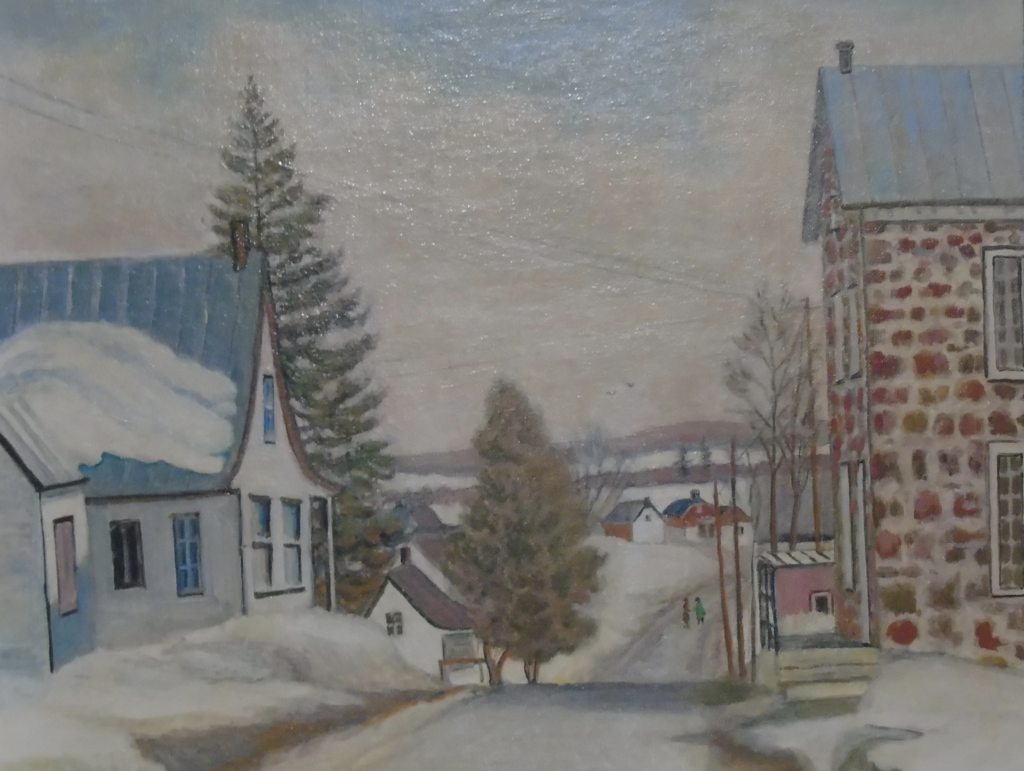
This painting by Linda Blagrave, a descendant of an early family in Rawdon, shows the stone building with a metal roof built in Ste Julienne to house future court records after a fire destroyed all the records in Berthierville.
In accordance with the 1757 agreement, Quebec Civil Law was based on the French Legislation but Criminal Law was of English origin. Lower Canada was divided into five legal circuits, Berthierville being the seat for the Rawdon area.
At this early stage the Church of England was the only official religion the Canadas was governed by the Lord Bishop of Quebec. In Lower Canada the Lord Bishop had one archdeacon with some 30 clergymen and a like number of churches under his jurisdiction.
The Church of England was supported by parliamentary aid as well as the Church Missionary Fund. The Rev. Burton, the first clergyman in Rawdon, was sent by the Missionary Society.
In the new country government funding through minimal taxes and duties. There was also a 2% import duty, and a 5% duty on liquor. Anyone selling liquor, tavern keepers, and pedlars were subject to an annual licensing fee. Other government revenue was from fines and the sale of crown lands.
The main towns of Lower Canada were Quebec City with a population of 15,000, Montreal with approximately 11,000, Trois Rivières with a little over 1000, population and William Henry (Sorel) with less than 2000 people.
Trois Rivières was halfway between Quebec City and Montreal. It was an important city with its port shipping lumber as well as products from Les Forges de St. Maurice which was for many years the most important iron works in North America.
Montreal, a much newer settlement, was the last town of note in Lower Canada. Settlers going on to Upper Canada embarked on watercraft in Lachine on the western end of the island to reach their destination.
In Rawdon several land grants were given to military personnel (or their widows) stationed at William Henry possibly in the hope these people would be interested in settling on their granted land. None of these grantees settled in Rawdon. The land was sold to others wishing to settle in the area.
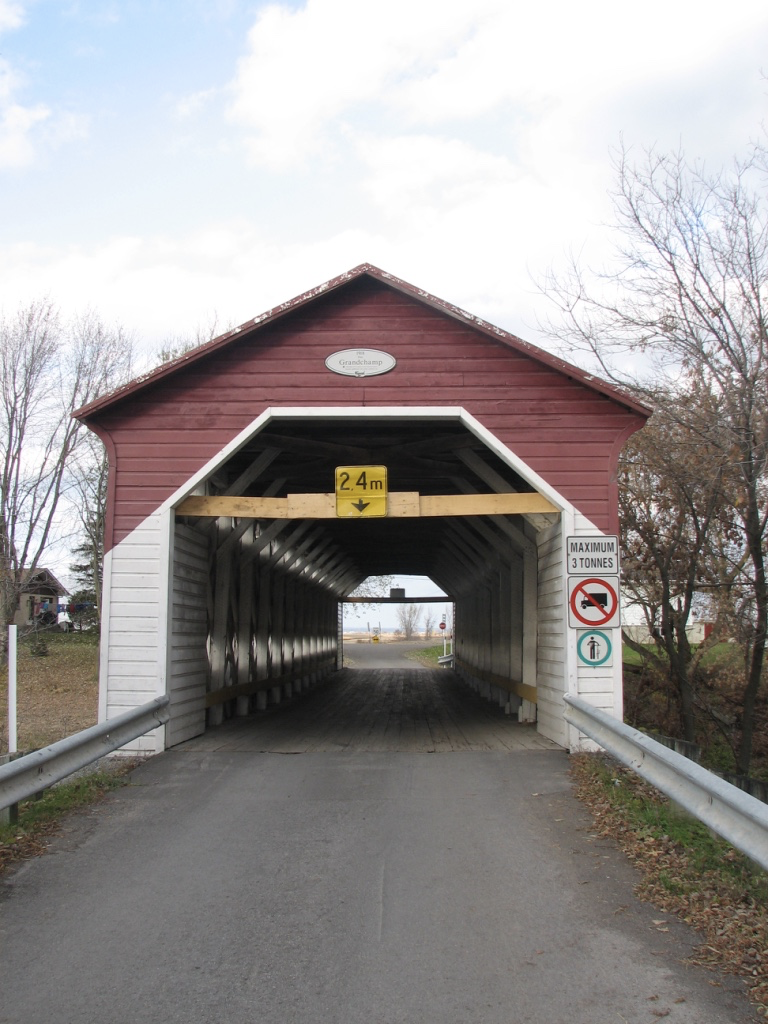
Travellers going to the Township through Berthierville crossed the Bayonne River on a covered bridge built under the French regime. In 1918 this old covered bridge was replaced. A few years ago when the new bridge could no longer support vehicle traffic the bridge was for pedestrians only. Reinforcements were added about fifteen years ago and the bridge was open to cars and light trucks. Crossing the bridge from the present day highway and following the river is a lovely drive with well maintained old farmhouses lining the road.
Although the St. Lawrence River was well traveled both by passenger and freight, there was a well-maintained road, along the North Shore of the St. Lawrence River, between Quebec City and Montreal, known as Le Chemin du Roi. This road runs along the river in front of the farms that hug the shores of the river. Today this road is a lovely, scenic drive. Some of the original houses are still standing and well restored. Little villages, each with a huddle of business establishments and a church, are encountered about every 4 or 9 miles.
Berthierville, 135 miles along the “Chemin du Roi” between Trois Rivières and Montreal was the usual inland approach to the Rawdon Township from Quebec City. After 1809 steamboats plying the St Lawrence River debarked at Berthierville to allow prospective settlers continue travel by foot or wagon to the Rawdon Township.
Berthierville, founded under the French regime, was seen as the principal town in this area with court documents kept there. Unfortunately a fire totally destroyed the building and its contents, including early Township records. The storage of the files were moved to Ste Julienne to be stored in a building entirely built of stone covered with a metal roof. (See Linda Blagrave’s painting).
At Berthierville and there was, and still is, a ferry crossing to Fort William Henry (now Sorel de Tracy) on the south shore, a British military headquarters.
British settlements along the north shore of the St Lawrence began farther inland on the back edge of the French settlements. Here the land, no longer flat, rose to the mountains. The first two ranges of the Township, later mostly ceded to neighbouring parishes were relatively flat land. The 4th range upwards is a constant climb into the mountains.
Areas settled under the French regime were signeuries divided into farms 2 or 3 arpents wide by 20 or 30 arpents back. Buildings were on the front of the lots and fields stretched towards the back. This system with the houses within a short distance of each other had the advantage of alleviating the sense of isolation experienced by newcomers in a strange and hostile environment. It also offered protection from marauding natives both for the women in the homes and the men working in the fields.
There are records of kidnappings and physical attacks in both fields and houses by aboriganals.
Land farther back from the river was evermore hilly and rocky as the mountains reached upwards rendering the French system no longer practical. Under the English regime lots were larger and square. Ten square miles lots were divided into 2 lots of 10 acres wide, 20 acres back. Grants were usually for 1/2 lots, 100 acres, 10 acres wide, 10 acres back.
Today this variation of settlement is easily discerned when driving through areas of French or English settlement.